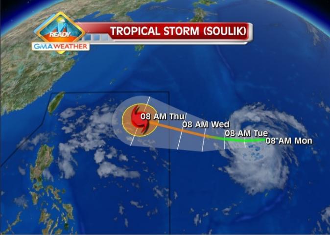
Tropical Storm Soulik intensified anew Monday afternoon as it moved closer to the Philippine Area of Responsibility, state weather forecasters said.
In a radio interview, PAGASA forecaster Gladys Saludes said Soulik is expected to enter the PAR Wednesday afternoon.
"Bahagya ito lumakas... by Wednesday afternoon papasok ito ng Philippine Aea of Responsibility," Saludes told dzBB radio.
Once it does, she said the tropical storm will be locally codenamed Huaning. She said the storm is expected to enhance the southwest monsoon.
Saludes said that as of 5 p.m., Soulik was estimated at 2,010 km east of Basco, Batanes, packing maximum sustained winds of 85 kph and gustiness of up to 100 kph. It is moving west at 20 kph, she added.
"Maghahatak ito ng habagat sa Huwebes," she said.
The Japan Meteorological Agency, meanwhile, projected that Soulik may continue to move west.
Tuesday outlook
PAGASA's 5 p.m. bulletin said the Intertropical Convergence Zone will continue to affect Palawan and Mindanao.
"Light to moderate winds blowing from the east to southeast will prevail over Luzon and coming from the east to northeast over Visayas and Mindanao. The coastal waters throughout the archipelago will be slight to moderate," it said. — RSJ, GMA News
article from http://www.gmanetwork.com/news/photo/40423/tropical-storm-soulik-forecast-track-as-of-8jul2013

0 comments:
Post a Comment